
The natural hazard disclosure report California law requires is a six-box map check, not a verdict on your house. Each box answers one question: does this parcel fall inside a state- or federally-drawn polygon? Nothing more. In Claremont, most of those boxes come back clear for a home near the Village or south of Foothill Boulevard, and the fire box is the one that changes as you drive north toward the foothills. You have three days to act on the report if it was handed to you in person, five if it came by mail. So read it the day it lands.
This is a box-by-box guide to what the report actually says about a Claremont property, what each flag triggers with your insurer and your lender, and the specific map you should open to check the state's work.
The six boxes on the natural hazard disclosure report California law requires
California Civil Code Section 1103 requires the seller to tell you whether the property sits in any of six mapped hazard zones. The statutory list splits neatly into pairs: two flood, two fire, two seismic.
- Special Flood Hazard Area — FEMA's Zone A or V, the 1% annual chance floodplain.
- Area of Potential Flooding (dam inundation) — the footprint mapped downstream of a dam failure.
- Very High Fire Hazard Severity Zone — CAL FIRE's hazard modeling inside city limits.
- Wildland Area / State Responsibility Area — land where the state, not the city, carries fire protection responsibility.
- Earthquake Fault Zone — an Alquist-Priolo zone drawn around an active surface fault trace.
- Seismic Hazard Zone — a state zone of required investigation for liquefaction or earthquake-induced landslide.
You can read the statute's own language at California Civil Code 1103.2. Most sellers do not draw these conclusions themselves. The natural hazard disclosure report California buyers receive is almost always a commercial product: the seller orders it from a third-party vendor, who runs the parcel against the government maps and signs off on the result. That vendor's job is geometry. It is not an inspection, not an engineering opinion, and not a statement about how your specific structure would perform.
One practical note before you read further. The report you receive is usually 20 to 40 pages, and only the first page — the Natural Hazard Disclosure Statement itself — is statutory. Everything behind it is the vendor's supplemental material: tax bond summaries, airport influence areas, methamphetamine cleanup notices, sometimes a wildfire risk narrative. Useful. Not the same legal weight.
Which of the six zones actually touch Claremont
Here is where every national article stops being useful. Claremont is 13 square miles that climb from roughly 1,000 feet near Arrow Highway to well above 2,000 feet at the northern edge, and the hazard maps follow that climb.
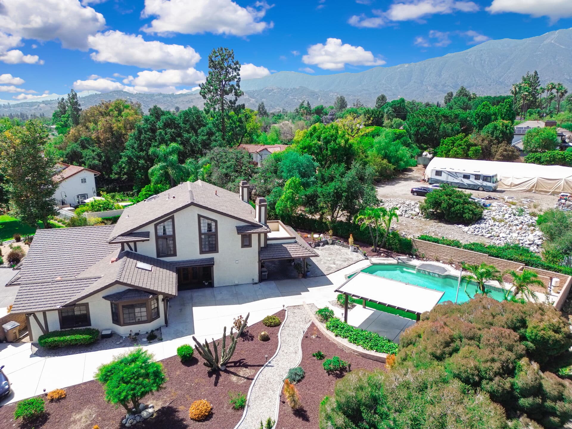
Fire. This is the live box in Claremont. CAL FIRE released updated Fire Hazard Severity Zone maps for Los Angeles County's local responsibility areas on March 24, 2025, and the City of Claremont posted the resulting map for residents. The Very High and High zones sit on the north side of town, in and near the foothill terrain around Mt. Baldy Road, Padua Avenue, and the wildland edge above the city. Flat-land parcels — the Village, the blocks around Indian Hill Boulevard and the Packing House, the tracts south of Foothill Boulevard, the neighborhoods near the Claremont Colleges — generally sit outside the zone. Generally. The line is drawn parcel by parcel and it moved in 2025, so a listing described as "not in a fire zone" three years ago may not be accurate now.
Wildland / State Responsibility Area. Claremont is a local responsibility area, so this box usually comes back "No" for a property inside city limits even when the fire hazard box is checked. Two different questions: one is about hazard, the other about who fights the fire.
Seismic. The San Gabriel range front is directly north of the city, and the state maps zones of required investigation for liquefaction and earthquake-induced landslide across the Los Angeles basin. Whether a specific Claremont parcel falls inside one is an address-level question, not a citywide one.
Flood. Most of Claremont's developed core sits well outside FEMA's mapped 1% annual chance floodplain, but the drainage north of Baseline Road is a real feature of the landscape, not a formality. Thompson Creek and its flood control channel run through the north side of town, and the Army Corps of Engineers operates San Antonio Dam on San Antonio Creek to the northeast. When storms fill that system, north Claremont notices. Both ABC7 and the Claremont COURIER covered groundwater flooding in the Stone Canyon area tied to releases from the dam.
A checked box describes a polygon, not your house
This is the distinction that should change how you feel when you open the report, and no competing article makes it plainly.
The state draws hazard zones at landscape scale, using fuel types, slope, weather patterns, and historic fire behavior. The polygon has a hard edge. Your parcel is either inside it or outside it. But wildfire does not respect a property line, and neither does a hillside. A home 200 feet outside a Very High zone, downwind of the same canyon, with untrimmed eucalyptus overhanging a wood-shake roof, carries more real exposure than a stucco-and-tile house inside the zone with 100 feet of cleared space, ember-resistant vents, and a Class A roof.
So the map tells you what regulation applies. It does not tell you what will happen. Read the flag as a prompt to go look at the actual conditions: the slope behind the house, the vegetation on the neighbor's lot, the width of the street a fire engine would have to back down, the age of the roof.
The same logic runs the other way on flood. A parcel outside the Special Flood Hazard Area can still take on water from a saturated hillside, a blocked local storm drain, or rising groundwater — none of which FEMA's map is designed to predict. FEMA maps riverine and coastal flooding. It does not map your street's drainage.
What a fire hazard severity zone disclosure changes about insurance
Buyers hear "Very High Fire Hazard Severity Zone" and assume the policy quote is about to double. The relationship is real but indirect, and the state has been unusually direct about it.
The California Department of Insurance issued a consumer alert on April 4, 2025, titled plainly: CAL FIRE hazard maps do not affect insurance rates or availability. Insurers have used their own proprietary wildfire risk models for years, not the state's zone maps, and those models weigh structure-level factors the hazard maps ignore. A change in your parcel's designation is unlikely, on its own, to move your premium.
Here is the catch. Those private models draw on much of the same underlying data — fuel, slope, weather, fire history — that produced the zone in the first place. So a Very High designation is a reasonable signal that carriers already see elevated risk at that address, even though the designation itself is not the input.
What to do with a fire flag, in order:
- Get a real quote before you remove your contingencies, not an estimate. Give the carrier the address, the roof type, the year built, and the defensible space condition.
- Ask the seller what they currently pay and with which carrier. Ask whether they have been non-renewed.
- Price the FAIR Plan plus a difference-in-conditions policy as your fallback, so you know the ceiling.
- Confirm your lender will accept the coverage form you can actually get.
There is also a seller-side rule that rides along with a fire flag. Under AB 38, a 2019 law whose checklist requirement took effect July 1, 2025, sellers of homes built before January 1, 2010 in a High or Very High Fire Hazard Severity Zone must give the buyer a list of low-cost fire-hardening measures and state which ones the property already has. Nobody is required to make the upgrades. They are required to tell you what is missing. Read that checklist as a repair budget.
What an earthquake fault zone flag does to lending and remodeling
The Alquist-Priolo Earthquake Fault Zoning Act dates to 1972 and has one narrow purpose: keeping habitable structures off active surface fault traces. The California Geological Survey has mapped these zones in 37 counties and more than 100 cities.
If your report flags an Alquist-Priolo zone, the practical consequences land on construction, not on the purchase itself. Before a city can permit most new structures for human occupancy inside the zone, it requires a geologic investigation by a California-licensed geologist. If the study finds an active trace, a setback — commonly 50 feet — applies to new construction. That is a permit problem, and it is why the flag matters more to a buyer planning an addition, an ADU, or a teardown than to one buying a finished house to live in.
Conventional lenders do not generally refuse a loan over an Alquist-Priolo flag, and standard homeowners policies exclude earthquake damage regardless of zone. Where the flag bites is timeline and cost: a required geologic report can add thousands of dollars and weeks to a remodel you assumed was routine. Ask that question during escrow, not after you have hired an architect.
A seismic hazard zone flag — liquefaction or landslide — works the same way. It triggers a site investigation requirement at the permit counter and tells you the state considers the ground worth studying.
Flood and dam inundation: what the lender requires and what you should check
These two boxes carry very different weight, and the difference is money.
A Special Flood Hazard Area flag has teeth. If you are financing with a federally backed or federally regulated loan and the structure sits in a mapped Zone A or V, flood insurance is mandatory for the life of the loan. Your lender will require proof before closing, and the premium becomes part of your monthly cost. Get a quote immediately; do not wait for the lender to raise it at day 18 of a 21-day escrow.
A dam inundation flag has none. It is disclosure only. No federal mandate, no lender requirement, no automatic insurance consequence. It tells you the property sits inside a modeled failure footprint — a low-probability, high-consequence scenario that emergency planners map so evacuation routes can be built. It is information for your household plan, not a line item in your loan file.
One caveat worth naming. Standard homeowners policies exclude flood. If you buy in north Claremont near the creek drainage and the box is unchecked, you still have no flood coverage unless you buy it. Outside a Special Flood Hazard Area, that coverage is typically inexpensive.
The map to check for each natural hazard disclosure report California flag
The report is the vendor's read of the maps. These are the maps. Spend twenty minutes here and you will know more about the property than most buyers ever learn.
- Very High Fire Hazard Severity Zone — open the CAL FIRE Office of the State Fire Marshal FHSZ viewer, enter the address, and confirm the designation against the current 2025 map. Then look at the parcels around it.
- Wildland / State Responsibility Area — the same viewer distinguishes state responsibility areas from local ones. Inside Claremont city limits, expect local.
- Earthquake Fault Zone and Seismic Hazard Zone — use the California Geological Survey's EQ Zapp tool, which shows Alquist-Priolo fault zones and zones of required investigation against any parcel in the state.
- Special Flood Hazard Area — run the address through Cal OES MyHazards, which reports the FEMA flood zone alongside fire and earthquake hazards, then confirm the FIRM panel and its effective date with FEMA's Flood Map Service Center. Maps get revised.
- Dam inundation — inundation maps are filed with the California Office of Emergency Services and the operating agency. For the San Antonio Creek system, that operator is the Army Corps of Engineers.
- All six — then call Claremont's planning counter and ask what the flag means for permits on that specific parcel. City staff answer this question routinely.
If a map and the report disagree, tell your agent in writing before your contingency period ends. Vendors do make errors, and parcel-boundary calls near a zone edge are exactly where errors happen.
Your clock, and what to do inside it
Under Civil Code 1103.3, delivery of the disclosure after you have already signed the contract gives you a termination right: three days after delivery in person, five days after delivery by mail or electronic delivery. That window is short, and it runs in calendar days.
Practically, in a Claremont escrow, the NHD arrives in the seller's disclosure package early. Do not stack it under the inspection reports. Open it first, because the two flags that can genuinely change your budget — fire insurance and mandatory flood insurance — both take days to price, and both are cheaper to discover in week one than in week three.
Sellers: order the report when you list, not when you go into escrow. A fire flag on a foothill-adjacent property is not a deal-killer, but a fire flag revealed in day 12 of escrow, alongside a home-hardening checklist you have not filled out, invites a renegotiation you did not need to have.
If you want a second read on a specific Claremont address — whether the north-side line falls above or below the property, and what it means for your insurance quote — reach out to Mr. Claremont™ for a one-on-one consultation.
Anthony Grynchal is a licensed California real estate agent (DRE #01873626) affiliated with eXp Realty and publishes under the Mr. Claremont Real Estate™ brand. He is the founder and CEO of MetaDLE™ Technologies, which operates the Designated Local Expert™ / UCI Coin™ products referenced in some posts. Articles are informational and are not legal, tax, or financial advice; market figures change and should be verified against current data before acting.
Frequently asked questions
Who pays for the NHD report in a Claremont sale?
The seller customarily orders and pays for it in Los Angeles County transactions, but it is a negotiable term in the purchase agreement, not a rule. Reports typically run in the low hundreds of dollars. If a seller resists ordering one, that is worth a conversation on its own.
Does the NHD report cover Mello-Roos, Megan's Law, or airport noise?
Not as part of the six statutory hazard boxes, though most commercial vendors bundle those items into the same booklet. Special tax and assessment disclosures, sex offender database notice, and airport influence areas arrive under separate statutes. Check which pages of your packet are the statutory disclosure and which are the vendor's add-ons.
Can I rely on the seller's report, or should I order my own?
For the six mapped zones, the seller's report is generally sufficient — the vendor carries the liability for its accuracy against the maps. Order your own only when the parcel sits near a zone boundary, when the report predates the March 2025 fire map update, or when the property has been subdivided or re-parceled since the report was issued.
Does an NHD report expire?
There is no statutory expiration on a natural hazard disclosure report California sellers deliver, but the maps behind it change. A report pulled before CAL FIRE's 2025 Los Angeles County update may show a fire designation that no longer matches the current map. If a deal falls out and the property relists months later, ask whether the report has been refreshed.
Will a hazard flag hurt resale value in Claremont?
The flag itself matters far less than the insurance cost attached to it. Buyers price what they have to pay every year, not what a box says. A foothill-adjacent home with a hardened roof, cleared defensible space, and a documented insurable premium competes well. The same house with an unaddressed hardening checklist and no current quote is where the discount shows up.

Written by
Anthony Grynchal
Anthony Grynchal is a California real estate professional with eXp Realty, licensed since November 2009 (California DRE# 01873626), and the Designated Local Expert™ for Claremont — where he has lived for more than 33 years.
More about AnthonyPublished · Updated